
Walk an Oak Hill Street
A sound Oak Hill street directory search separates ownership, occupancy, and history. The Fayette County Assessor can connect a street address to a tax parcel and the owner shown for that tax year. The parcel viewers show the lot in relation to nearby lots. A recorded deed can then support the ownership link. None of those sources, alone, names every person who sleeps at the address. A voter record or an old directory may add a resident clue, but each belongs to a certain date and has its own access rules.
- Enter the number and street in the Fayette IAS real-property form. Select the required tax year and jurisdiction, then save the parcel ID and owner display.
- Open the state Property Viewer or Fayette parcel map. Match the parcel number, note adjoining lots, and record the map layer or date.
- Use the deed book and page, legal description, or owner name to reach the Fayette County Clerk. Confirm the actual recorded instrument.
- For voter evidence, use the personal GoVoteWV status lookup only with the required name and birth date, or follow the lawful county inspection process.
- For older households, ask the library or state archives for the right directory, census district, newspaper reel, or historic map year.
The trail is strongest when the same parcel number or legal description appears in more than one official source. Write down dates. A current tax card and an old directory describe different moments, even when the street text matches.
Search Oak Hill Addresses in IAS
The West Virginia IAS real-property search is the best first index for a modern address. It offers far more than one text box. Tax Year and Jurisdiction are required selectors, so a blank result can reflect an incomplete form. Search the surname, street, and parcel separately when spelling or spacing is uncertain. Preserve the exact district-map-parcel-suffix because it is the bridge to GIS and the deed record room.
| IAS field | Use in a street search | Format note |
|---|---|---|
| Parcel Address Number and Street | Find lots along one named road | Try the street without a number for a wider result |
| ZIP Code | Limit results to the 25901 postal area | ZIP does not prove Oak Hill city limits |
| Owner Name 1 and 2 | Match the tax-roll owner | An owner is not always the occupant |
| Book and Page | Bridge from assessment to recorded deed | Verify the full instrument with the clerk |
| Tax Year and Jurisdiction | Fix the time and county context | Both selectors affect the result |
The Fayette Assessor disclaimer warns that assessment maps can be inaccurate and are not surveys. That makes IAS a discovery tool, not the last word on boundary or title.
The captured IAS form shows the actual controls used for an Oak Hill address search.
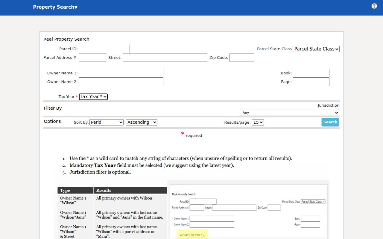
Its address, owner, book, page, ZIP, year, and jurisdiction fields let one search be checked from several angles.
Map Oak Hill Street Parcels
The WV Property Viewer accepts E-911 address, owner, street address, parcel attributes, and parcel number searches. It also supports point, rectangle, polygon, and buffer geometry. Those shapes help locate the lots around a road without assuming that a mailing address has the same boundary as a parcel. The Fayette parcel viewer adds layer, selection, measurement, and coordinate controls.
- Parcel
- A tract used for assessment, identified by a county parcel number.
- Situs address
- The physical location assigned to the parcel, which may differ from the owner's mailing address.
- Plat
- A recorded drawing that lays out lots, lines, roads, or a subdivision.
- Criss-cross directory
- A directory arranged by street and house number instead of only by surname.
Oak Hill also maintains a city GIS page for planning, infrastructure, and public mapping contacts. Its public landing page did not expose a searchable address-to-parcel table in the research capture, so use it for city context and ask the GIS office when the state and county maps leave a boundary question unresolved.
Oak Hill Records Sit in Fayetteville
Oak Hill is not the Fayette County seat. The assessor and county clerk offices are in Fayetteville, which matters when an online index stops short. The Fayette County Assessor contact page lists the real-estate and GIS phone channels at the county annex. Current map cards are best checked with staff or in person when the online view is incomplete.
The captured assessor contact page gives the practical fallback behind a by-address search.
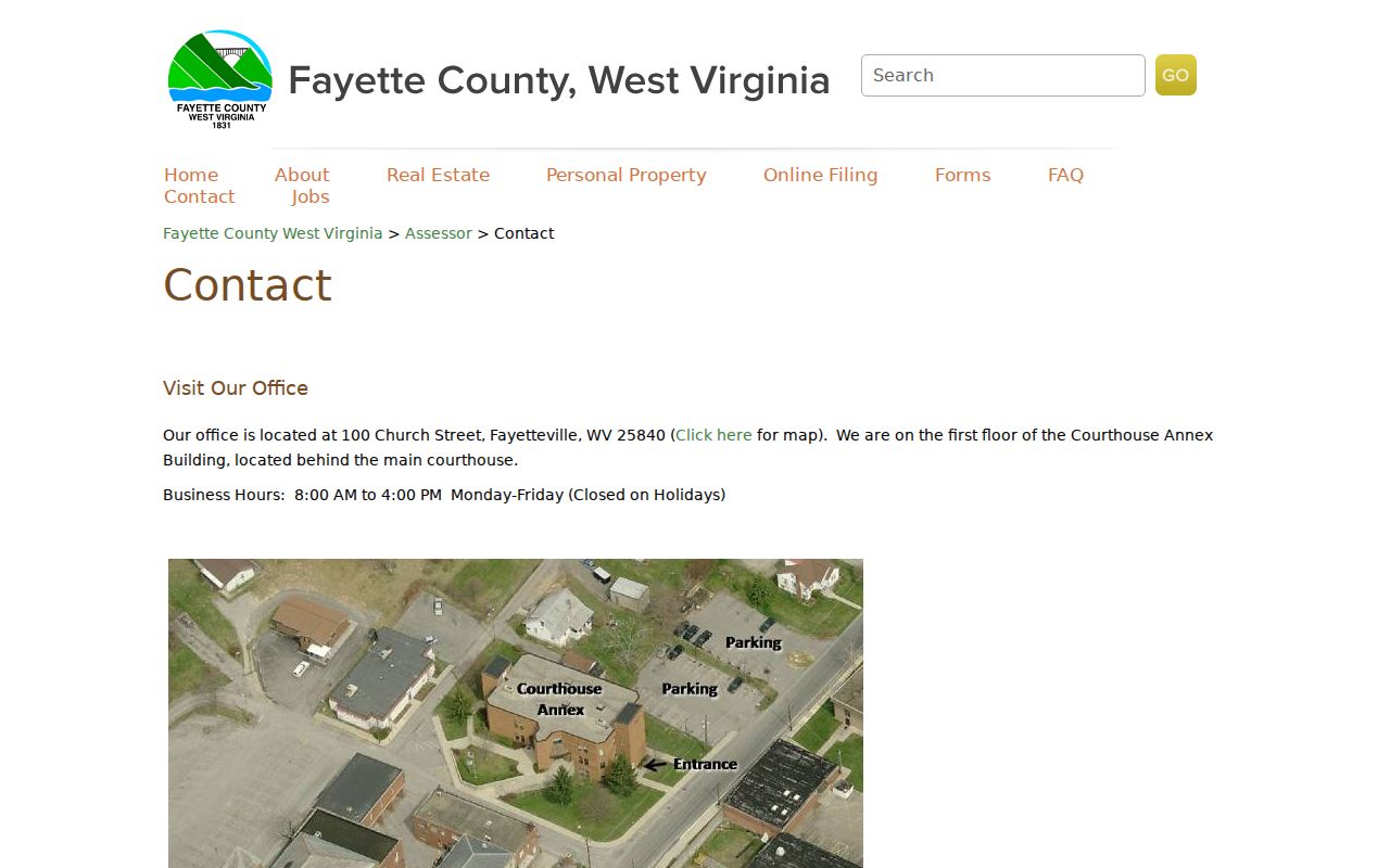
Calling with the parcel ID, tax year, and street spelling is more precise than asking staff to research a broad family name.
This city-county split is a useful geography clue. Oak Hill City Hall holds municipal forms and code matters, while the county maintains the tax roll and recorded land instruments. County offices publish weekday hours of 8:00 a.m. to 4:00 p.m.; City Hall lists a different workday. Confirm hours before an in-person visit.
Oak Hill Street Record Coverage
No single roll is a complete list by street. The useful record sets answer different questions: who receives the tax bill, how a lot is mapped, which deed was recorded, whether work was applied for, or whether a voter record may be inspected under state law. Check the access column before treating an absence as meaningful.
| Record Set | Keeper | What It Shows | Access |
|---|---|---|---|
| Property and tax roll | Fayette County Assessor | Tax owner, situs, mailing address, parcel, value | Free IAS portal, phone, or office |
| Parcel maps | Fayette GIS and WV Property Viewer | Lot geometry, nearby parcels, map attributes | Free viewers; verify with assessor |
| Deeds, liens, and releases | Fayette County Clerk | Recorded parties, legal description, ownership chain | Online dates vary; record room and archives fill gaps |
| Voter file | County Clerk and WV Secretary of State | Registration and election geography within legal limits | Personal status tool or statutory inspection/request |
| Permits and code files | Oak Hill and Fayette offices | Application, address, project, dates, decisions | Forms online; records may require a narrow request |
The parcel number links the assessor, GIS, and recorded instrument more safely than a name does. Street names help with permits, directories, and voter geography, but they can be spelled or classified in several ways. Keep the source date with every result.
Follow Oak Hill Deeds by Address
The Fayette County Clerk advertises deeds from 1981 forward and most other online record categories from 1993 forward unless noted. Search or request the grantor/grantee index with the tax owner, parcel, legal description, and an approximate year. A grantor transfers an interest; a grantee receives it. Capture the book and page or instrument number, both parties, record date, legal description, releases, and references to an earlier instrument.
The online date range is not the age of the land record. Older deed books and grantor/grantee indexes may be in the county record room or on state archive microfilm. Call the record room at 304-574-4262 to learn where the volume sits. The county page was also captured as the safe West Virginia entry point.
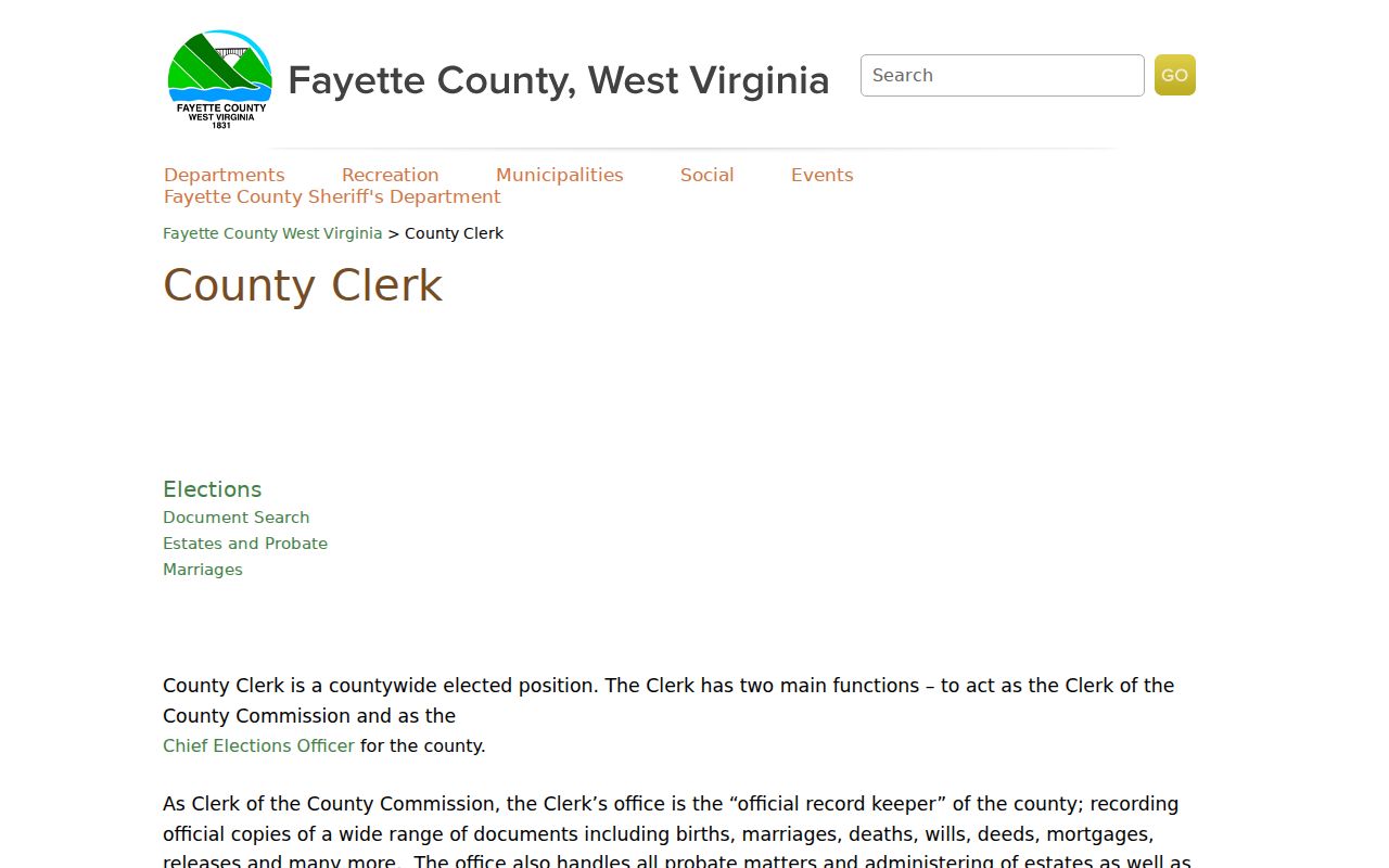
This source prevents a common error: search results for another Fayette County must not be mistaken for Fayette County, West Virginia.
Note: An IAS deed reference is a handoff clue; the recorded document, not the tax-card abbreviation, supplies the legal instrument details.
Oak Hill Permits by Street
The Oak Hill permit page lists construction, roof, electrical service, fence, pool, and demolition applications. City forms also cover zoning, variances, vacant structures, and fire reports. These files can connect an applicant, owner authorization, project, and date to an address. An application does not prove that a permit was issued, an inspection passed, or work was finished.
No public address-indexed permit history was found. Use the West Virginia Freedom of Information Act for a focused request to the direct custodian. State the address, permit or code-record type, and date range, and ask for segregable records if personal fields are protected. The custodian may provide the record, set an inspection, or deny in writing within the statutory maximum of five days excluding weekends and legal holidays.
Oak Hill Streets Cross Record Lines
ZIP 25901 is a postal clue, not a city boundary. Compare a USPS address with the Census Oak Hill boundary map, city GIS, and IAS jurisdiction before labeling a parcel as inside the city. Annexation material also covers Minden and corridors near US 19, State Route 16, Route 612, Gatewood, Summerlee, Lochgelly, Scarbro, and Pea Ridge. A familiar community or postal name can remain after a boundary change.
Historic work needs another layer. The White Oak rail corridor and early road patterns can explain why a current spelling or lot layout fails in an older source. Pair the old address with a map year, directory year, census enumeration district, and deed description. The Oak Hill city directory collections are the right place to continue that older household trail.
Oak Hill Voters Are Not a Street List
GoVoteWV checks one voter's status with a first name, last name, and date of birth. It does not browse every voter on an Oak Hill road. West Virginia Code §3-2-30 allows inspection of active, inactive, rejected, and canceled voter records through the election custodian, but excludes phone numbers, email addresses, Social Security numbers, and driver or nonoperator identification numbers. State request forms also restrict solicitation, advertising, and resale.
When a lawful project calls for a precinct or municipal list, contact the Fayette County Elections office rather than trying to turn the personal status screen into a street directory. State files may use a mailing address, precinct, or protected substitute address. Compare any permitted entry with the parcel and deed dates, and never infer every person in a home from one voter record.
Note: The West Virginia Address Confidentiality Program protects qualifying survivors through a substitute address and mail forwarding.
Limits of Oak Hill Street Records
An assessor result names a tax-roll owner, not every person in the building. GIS outlines an assessed parcel, not a surveyed boundary. A permit shows an application or action, while a voter-status result describes one eligible person's registration at the time the system was updated. Old directories, census sheets, obituaries, and newspapers are historical evidence. None should be presented as proof of a current Oak Hill resident without fresh, lawful confirmation.
The West Virginia Address Confidentiality Program gives qualifying survivors a substitute address and mail forwarding. Do not try to reverse that protection by joining records together. Voter files also omit phone, email, Social Security, and driver identification data, and state law restricts solicitation, advertising, and resale uses.
Lawful use. Use Oak Hill address records only for a lawful personal purpose. West Virginia law does not permit stalking, harassment, threats, or attempts to expose a protected address.
A missing web result is not proof that no record exists. It may sit outside the advertised online years, behind a dynamic gate, in an unindexed book, at the record room, or under a lawful restriction. Ask the named custodian and describe the desired record precisely.